
Dana Point Neighbors: Source Map
An address gives a block lookup its shape, but no single Dana Point record names every person nearby. Dana Point Community View supplies parcel geometry. The Dana Point county roll separates value and exemption data from the fuller information available at a counter. Dana Point RecorderWorks traces recorded parties and instrument references. Dana Point city permits add project history, while a Dana Point licensed short-term-rental list covers only that regulated program. Dana Point voter data has a separate statutory gate. Dana Point civic groups and neighborhood organizations can provide public contacts or events, yet their private rosters stay private. Reading these sources as different kinds of evidence keeps a Dana Point neighbors search focused on a fact that the custodian can actually support.
| Source | What It Shows About a Block | Access |
|---|---|---|
| Dana Point Community View | Situs address, APN, parcel lines, adjacent parcels, and planning layers | Free web GIS; visual click |
| Orange County Assessor roll for Dana Point | APN, value, and exemption data; fuller ownership or mailing clues at the counter | APN web route; counter for more |
| OC RecorderWorks | Grantor, grantee, date, document type or number, and APN or legal-description routes | Free index; images not online |
| Dana Point permits | Applications, plan review, and inspections tied to property records | eTRAKiT; public fields vary |
| Dana Point licensed STR list | Address, permit, ZIP, APN, owner or mailing address, and manager contact | Limited regulated program |
| Dana Point qualified voter data | Lawful file fields such as residence, mailing, status, precinct, and participation history | Approved purpose only |
| Dana Point Neighborhood Watch | Organized safety presence, not a member roster | Confidential information sheet |
| Dana Point civic organizations | Public contacts, activities, and local context | Not a resident directory |
Owners and occupants are different facts. A situs address identifies the land. A mailing address may be elsewhere and can suggest that the owner does not live at the parcel, but it does not prove who stays there. A deed names parties to a recorded instrument. A permit names people tied to a project. A voter record concerns a registration, not everyone in a home. Even a matching mailing and situs address is only owner-occupancy evidence. It is not a list of household members, children, guests, or nearby people.
Note: A block source is strongest when its field, date, and custodian are recorded beside the address or APN.
Dana Point Neighbors by Parcel
Dana Point Community View is address-friendly because the first task is to locate land, not to run an owner-name search. The Dana Point official mapping instructions describe a search box that accepts a street number and name. For a Dana Point address, city, state, and ZIP are not needed, and a street alone moves the map to a vicinity. Choose a view, zoom until Dana Point parcel outlines appear, and turn on Property Lines or Parcel Information before clicking the target.
| Control | Type | Required | Format or Use |
|---|---|---|---|
| Search | Free text or autocomplete | No | Street number and name; omit city, state, and ZIP |
| APN syntax | Free text | No | APN:XXXXXXXXX |
| View | Dropdown | No | Changes the map or layer view |
| Zoom | Plus or minus control | No | Reveal parcel outlines |
| Drag | Map pan | No | Move along the block |
| Parcel click | Identify tool | No | Open the parcel information bubble |
The Dana Point map can layer color aerials, beaches, city boundary, coastal zone, Coastal Commission appeals, fire hazards, land use, parks, property lines, parcel information, PRDs, specific plans, trails, contours, water and sewer districts, wedding sites, and zoning or classification. A Dana Point parcel bubble may expose the address, APN, bird's-eye or Bing photos, property summary, zoning, and layer attributes. Dana Point city has not documented a radius, buffer, or export tool. The useful method is visual: click immediately left, right, and across the street, then pan along the block.
That approach gives Dana Point neighbors a repeatable parcel set without claiming that a map edge equals a legal radius. It also keeps an empty or sparse parcel area, such as parts of the Headlands, from being mistaken for a failed search.
Dana Point Neighbors by APN
The Dana Point address-to-record path is a chain, not one search box: address → adjacent APNs → RecorderWorks and the Assessor → permits. Start with the Dana Point parcel map. Then carry each APN into the Dana Point county systems, keeping the parcel's situs address separate from any mailing address. The Orange County Assessor property portal for Dana Point accepts exactly eight numeric APN digits and does not offer a public owner-name or street-address search. Its Dana Point web result is basic property, value, exemption, and roll-date information.
- Search the number and street in Dana Point Community View, or use its APN mode, and save the nine-digit APN shown for the target parcel.
- Click the Dana Point parcels on both sides and across the street. Record each address, APN, and any boundary or planning layer that explains the block.
- Use the eight-digit APN format in the Dana Point Assessor web portal for value and exemption data. For fuller current ownership or mailing context, use the public counter at 500 S. Main Street, second floor, Orange, Monday through Friday, 8 a.m. to 5 p.m.
- Search the APN or a lawfully known party in the OC RecorderWorks route for Dana Point. In name mode, use LAST FIRST, no punctuation, and narrow the date range when needed. Capture the grantor, grantee, document type, date, instrument number, and legal description route.
- Check Dana Point eTRAKiT for permit history dating from incorporation in 1989. A permit applicant, owner, contractor, or project contact is not proof of who occupies the parcel.
Dana Point RecorderWorks is computerized from January 4, 1982 to the present. Its document-number link opens the index entry, not an image, and staff will not perform the grantor or grantee search for a requester by phone, mail, or in person. Before 1982, the Dana Point trail moves to Santa Ana index books or microfiche and requires a book, page, or instrument reference when available. When the question expands from the immediate block to every address on a named road, the Dana Point street directory route keeps that work street by street.
Note: An APN joins land records across systems, while a name alone can join two different people.
Dana Point Block Records
Several Dana Point record terms keep the trail honest. They describe the field being searched, not a promise that the field identifies a complete household.
- APN
- A Dana Point assessor parcel number that ties a parcel to assessment and recorded-document routes; Community View and the Assessor portal use different digit formats.
- Situs address
- The physical location of the land shown on the Dana Point parcel map, which may differ from a party's mailing address.
- Mailing address
- A Dana Point record address used for correspondence; it can be off site and does not prove that the recipient lives at the parcel.
- Legal description
- Dana Point tract, lot, parcel-map, or metes-and-bounds language that can bridge a deed chain when street names or APNs change.
The same distinctions matter in Dana Point permits. Dana Point's online permit history can show an application, plan review, inspection, or project contact, but the researched interface does not expose every unauthenticated field. A code or planning layer can explain a use or boundary. Neither one is a resident card. If the Dana Point map bubble has no owner display, that is expected. Pair the APN with the lawful Dana Point county counter or the latest recorded instrument, then stop when the question has been answered.
Dana Point Neighborhood Contacts
A block also sits inside community structures that do not function like public rolls. Dana Point's community-organization material names the Dana Point Civic Association, Lantern Village Association, Dana Point Historical Society, Dana Point Woman's Club, Dana Point Monarch Beach Sunrise Rotary, Boaters' Association, Dana Point Chamber, Dana Point Community House, VFW Post and Auxiliary 9934, Boys and Girls Club of Capistrano Valley, Pet Project Foundation, and Stand Up To Trash. These contacts can point to Dana Point local history, events, or civic work. They do not certify who lives on a block.
Neighborhood contacts
Dana Point Civic Association and Lantern Village Association are public-facing Dana Point community names. A public contact or event notice is not a member list.
HOA context
Dana Point city budget records mention outreach to Lantern Village HOA, South Cove Community, Strands HOA, and Monarch Bay Community. Those mentions show an outreach layer, not private household data.
Civic and history groups
Dana Point Historical Society, Woman's Club, Rotary, the Boaters' Association, Chamber, Community House, VFW, Boys and Girls Club, Pet Project Foundation, and Stand Up To Trash add public context without a complete roster.
Lantern Village and South Cove may be useful search terms when reading planning or association material. Strands HOA and Monarch Bay Community appear in city outreach records, but a private roster remains with the association. A careful Dana Point neighbors lookup treats these groups as civic context, not as an alternate parcel database.
Capistrano Beach Neighbors
Dana Point's communities do not share one record history. Capistrano Beach and Doheny Village in Dana Point combine older residences with Coast Highway and Camino Capistrano commerce and light industrial or office uses. Search both place names, along with Dana Point, when an older deed, permit, newspaper, or community reference seems absent. The Dana Point postal or neighborhood label can be a clue to the right historical file, not proof that an address lies outside the city.
Dana Point's Lantern District and Lantern Village form the oldest planned core. Dana Point historical references use full names such as Street of the Green Lantern, Street of the Blue Lantern, Street of the Ruby Lantern, Street of the Amber Lantern, Street of the Violet Lantern, Street of the Golden Lantern, Street of the Silver Lantern, Street of the Copper Lantern, and Street of the Crystal Lantern. Search the full form, a shortened Street of form, and ordinary abbreviations. Dana Point's Monarch Beach is a later master-planned coastal area where tract maps, modern deeds, permits, and association contacts fit better than prewar directory assumptions.
Dana Point Headlands is roughly 35 acres with limited development, preserve land, and bluff or promontory features, so a visual parcel sweep can be sparse. The Dana Point Harbor lies within Dana Point geography but is county-administered. Dana Point's Sea Canyon, Dana Knoll, Town Center or the Lantern District, and South Cove or Stonehill add more local context. These names help explain why two nearby addresses can have different planning, civic, or historical trails.
Dana Point Neighbors and Voters
Dana Point voter information is not an open street browse. The Orange County self-lookup is designed for a person to confirm that person's own registration. A Dana Point self-lookup asks for date of birth, the last four digits of a California driver license or state ID, or the last four digits of an SSN when no ID exists, plus the first three letters of the first name. A verified result can show registration status, name, mailing address, party, history, and elected districts or officials. It does not reveal ballot choices.
The separate Dana Point county data route is purpose-limited. Elections Code sections 2187, 2188, and 2194, Government Code section 7924.000, and 2 CCR section 19003 govern access. A request needs an original wet signature, in-person or mail submission, a permitted-purpose narrative, supporting proof, a security and confidentiality explanation, photo ID, and prepayment. Email and fax are not the listed submission channels. A specific-record request can list up to ten voters, but no fixed turnaround is promised.
The Dana Point qualified voter-data request page shows the formal application route and its purpose limits.
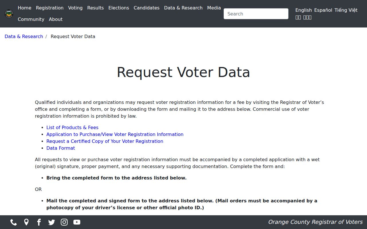
The Dana Point request record may contain residence and mailing address, phone, email, registration status or reason, registration date and method, precinct, party preference, and participation history. Driver or state-ID data, SSN and unique identifiers, signatures, and other protected fields stay closed. Safe at Home and confidential voter entries are omitted from ordinary public-purpose files. An approved recipient might sort lawful data geographically, but the public cannot turn that file into a general Dana Point neighbor list.
Dana Point Neighbor Watch
Dana Point Neighborhood Watch exists as an organized safety layer, but it does not publish a roster. The Dana Point Community Services Unit receives a Dana Point Confidential Information Sheet that asks for a name, address, ZIP, phone numbers, email, HOA, Watch interest, safety-topic ratings, and comments. The Dana Point sheet itself is evidence of a contact channel, not a list of participating homes.
Emma Peters is the listed Dana Point contact at (949) 248-3581 and epeters@ocsheriff.gov. A Dana Point fiscal-year 2017-19 budget recorded 24 active Neighborhood Watch groups at that time. That historical count must not be presented as a current total. Private Watch and HOA rosters, household details, children, and utility or delivery records remain outside a public block lookup.
Dana Point's use of California's Megan's Law site is a separate public-safety registry with name and map or address-area modes after its terms are accepted. Its identity, photo, physical or offense details, and mapped disclosures vary by statutory tier, and use restrictions apply.
The California Megan's Law search for Dana Point shows the registry gateway and its terms.
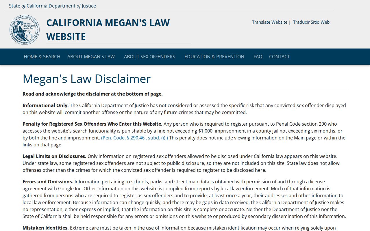
This registry is not a household directory or a way to identify every Dana Point neighbor. Harassment, discrimination, and attempts to use a public safety record as a tool for targeting people are outside its lawful purpose.
Dana Point Neighbor STR Clues
Dana Point's official short-term-rental list is a narrow address record. A Dana Point listed, licensed operation may show the address, permit, ZIP, APN, owner and owner mailing address, contact or manager, coastal-zone status, and permit type. The Dana Point STR list is unusually rich for a regulated program, but it is time-sensitive and does not describe ordinary households.
Use the entry only for the fact it records. A Dana Point owner mailing address can be off site. A manager or contact can be tied to the permit rather than the parcel's occupants. A Dana Point address absent from the list is not evidence that no one lives there, and an address on the list is not a complete Dana Point neighbors record. The list works best as one corroborating clue beside the Dana Point APN, deed index, and permit trail.
Note: A Dana Point licensed-program record is useful because its scope is stated; it becomes misleading when treated as a citywide household roll.
Dana Point Neighbors Compared
The key Dana Point comparison is source lineage, not how broad a search form looks. Dana Point official records tie a fact to a keeper, field, and date. Dana Point commercial address compilations may combine public and purchased data, merge names, lag changes, or repeat an old address. They can suggest a lead, but they do not replace the Dana Point parcel, recorder, city, or voter custodian.
| Source category | Best block use | Boundary to keep |
|---|---|---|
| Dana Point official parcel and county records | Join address, APN, title reference, value, or exemption facts | No complete household roster; owner is not the same as occupant |
| Dana Point city programs and civic contacts | Add permit, planning, safety, event, or local-history context | Program scope and private membership limits apply |
| Dana Point commercial address compilations | Offer a possible lead for a lawful personal question | Source, date, and identity may be unclear; verify with primary records |
California Safe at Home for Dana Point addresses is another boundary worth knowing. It provides address substitution and confidential mail forwarding for qualifying participants. It is not a promise to erase every historic record. California Government Code section 6208.1 can prevent public display of a participant's home address or phone in Dana Point records after a written nondisclosure demand. The result may be a protected gap, not a bad APN or an incomplete map.
For a Dana Point property-protection example, the Orange County real-estate fraud alert page explains the county's automatic, free courtesy notice.
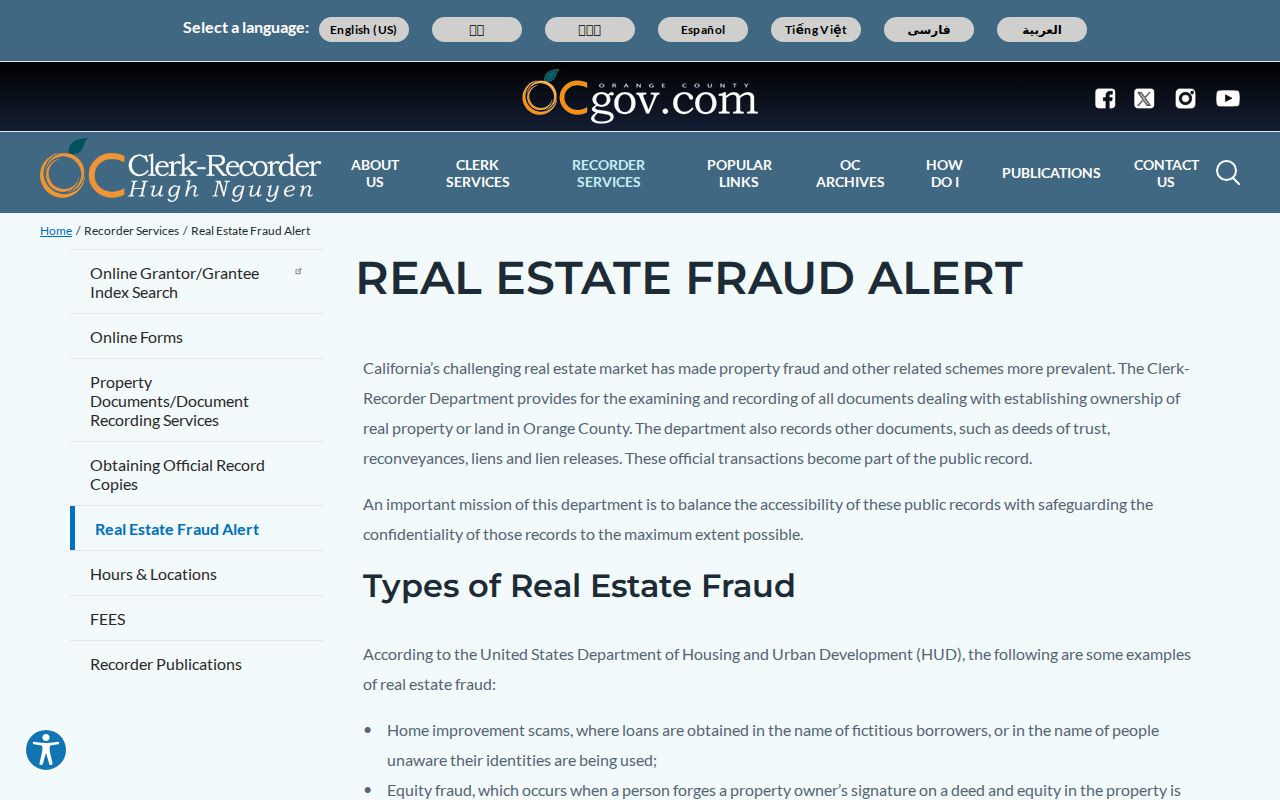
When a Dana Point document affecting title records, the county mails the owner a notice and first-page copy. That notice supplements, rather than replaces, periodic RecorderWorks checks and shows how a Dana Point official record can protect a property owner without becoming a neighbor roster.
Lawful use. Dana Point neighbor research belongs to personal, civic, family-history, and safety-awareness purposes. California Penal Code section 646.9 and Code of Civil Procedure section 527.6 address stalking, credible threats, and harassment; a public record does not make threatening use lawful.